Bathymetric Mapping
Bathymetry is the study of underwater topography and is a key component of fisheries science. Bathymetric mapping can provide a metric of habitat volume and substrate type, while water body depth is critical to habitat suitability. When used in combination with lake temperature monitoring, bathymetric mapping can provide important information on habitat for a broad range of species.

Sherbrooke Lake, Nova Scotia
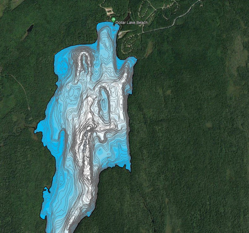
Dollar Lake Provincial Park

Shortnose Sturgeon side scan sonar survey